Achany Extension
(formerly Glencassley)
On Monday 23rd May 2023 the Scottish Government Energy Consents Unit approved SSE Renewables Section 36 application for the wind farm extension. A link to the application on the Scottish Government's website is here.
A section 36C application to vary the consent was submitted to the Energy Consents Unit on 24th October . This now sits with the Scottish Government and both local and statutory consultees for assessment and consideration. A link to the application on the Scottish Government’s website is here
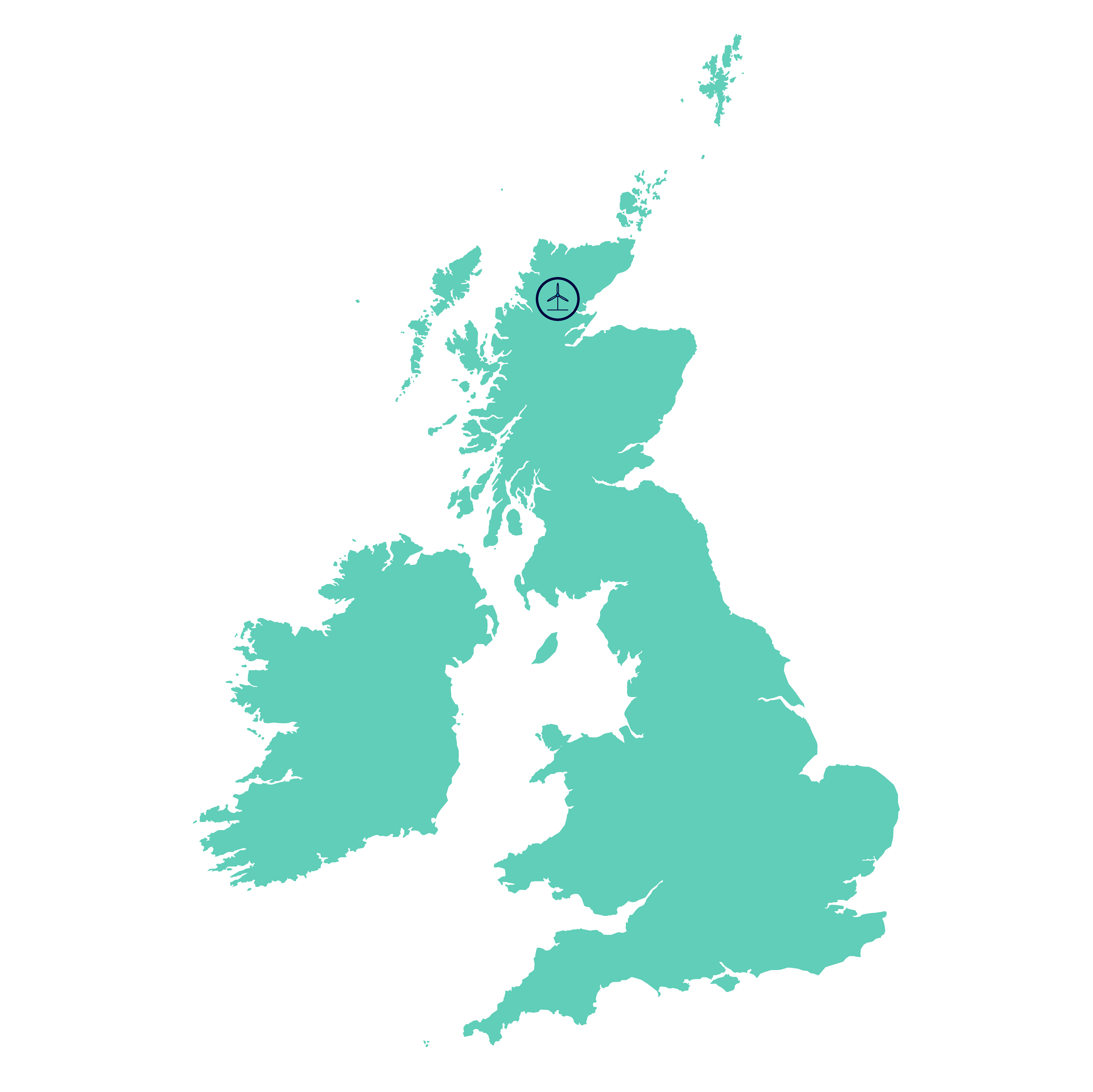
The proposed Achany Extension Wind Farm (formerly known as Glencassley) would be constructed on land adjacent to SSE Renewables’ operational Achany Wind Farm, approximately 4.5 kilometres (km) north of the village of Rosehall and 11km north-west of Lairg.
It is anticipated to generate in excess of 80 Megawatts (MW) while Achany’s existing 19 turbines already generate 38MW of renewable energy, meaning the combined capacity could generate in excess of 118MW.
Achany Extension at a glance
Section 36C Application
Since the project’s consent in May 2023, our project team has been working to progress the project towards construction; however, due to a range of economic challenges, it was determined that it will not be possible to progress the project in its current consented form.
Following a detailed project feasibility study and re-design, SSE has now submitted an application to vary the consent for the Achany Extension Wind Farm Development. The variation requests an increase in the tip height of the turbines to increase the energy output from the site. The turbine locations for remain unchanged from the Consented Development. The Varied Development application was submitted to the Scottish Government’s Energy Consents Unit (ECU) in October 2025.
This application is supported by a robust comparative Environmental Impact Assessment, new surveys and visuals where appropriate. Consultation with both the ECU through an official scoping request, and with local stakeholders at two public exhibitions has also been undertaken.
Project history
In 2012 SSE submitted an application for a 26-turbine wind farm. This application was subsequently refused by the Scottish Government in 2015 due to impacts on the National Scenic Area and ‘Wild Land’ despite the support of The Highland Council.
With the renewed appetite for onshore wind in Scotland and in the context of the ‘Climate Emergency’, SSE concluded that this site continued to offer excellent potential for a wind farm.
Achany Extension was redesigned and relocated a further 2km from previous proposals, closer to the existing wind farms, which also brought operational benefits in managing and maintaining the sites. The reuse of existing site infrastructure was incorporated into the design, allowing access to the extension through the existing site. A Section 36 application was submitted in July 2021.
In December 2021, the Highland Council unanimously agreed to raise ‘no objection’ to Achany Extension, subject to the removal of 2 turbines. Additional Information was submitted to the Highland Council and the Scottish Government’s Energy Consents Unit, which included an assessment of any environmental changes or impact that would result from a revised 18 turbine scheme.
Section 36C Application – October 2025
The application’s documents can be found on this webpage, via the links below, or on the ECU’s website here, using application reference number ECU00006178
- Volume 2 - Chapter 1 - Introduction
- Volume 2 - Chapter 2 - Design Iteration and Proposed Development
- Volume 2 - Chapter 3 - Approach to EIA
- Volume 2 - Chapter 4 - Planning Policy and Context
- Volume 2 - Chapter 5 - Landscape and Visual
- Volume 2 - Chapter 6 - Ecology
- Volume 2 - Chapter 7 - Ornithology
- Volume 2 - Chapter 8 - Hydrology and Hydrogeology
- Volume 2 - Chapter 9 - Geology and Carbon Balance
- Volume 2 - Chapter 10 - Cultural Heritage and Archaeology
- Volume 2 - Chapter 11 - Traffic and Transport
- Volume 2 - Chapter 12 - Socio-Economic, Recreation and Tourism
- Volume 2 - Chapter 13 - Noise and Vibration
- Volume 2 - Chapter 14 - Aviation and Radar
- Volume 2 - Chapter 15 - Other Issues
- Volume 2 - Chapter 16 - Schedule of Mitigation
- Volume 2 - Chapter 17 - Summary of Residual Effects
- Volume 2 - Contents
- Volume 2 - Cover Page
- Volume 2 - Glossary and Abbreviations
- Volume 3 - Contents
- Volume 3 - Cover Page
- Volume 3 - Figure 1.1 - Site Location Plan
- Volume 3 - Figure 1.2 - Consented Site Layout Plan
- Volume 3 - Figure 1.2a - Consented Site Layout Plan
- Volume 3 - Figure 1.2b - Consented Site Layout Plan
- Volume 3 - Figure 1.2c - Consented Site Layout Plan
- Volume 3 - Figure 1.2d - Consented Site Layout Plan
- Volume 3 - Figure 1.3 - Proposed Varied Development Plan
- Volume 3 - Figure 1.3a - Proposed Varied Development Layout Plan
- Volume 3 - Figure 1.3b - Proposed Varied Development Layout Plan
- Volume 3 - Figure 1.3c - Proposed Varied Development Layout Plan
- Volume 3 - Figure 1.3d - Proposed Varied Development Layout Plan
- Volume 3 - Figure 1.4 - Varied Development vs Consented Development Layout
- Volume 3 - Figure 2.1 - Indicative Turbine Geometry
- Volume 3 - Figure 2.2 - Indicative WTG Foundation
- Volume 3 - Figure 2.3 - Indicative Access Track Details
- Volume 3 - Figure 2.4 - Indicative LiDAR
- Volume 3 - Figure 2.5 - Indicative Crane Hardstanding Details
- Volume 3 - Figure 2.6 - Construction Compound - Indicative Layout
- Volume 3 - Figure 2.7a - Indicative Substation Plan
- Volume 3 - Figure 2.7b - Indicative Substation Elevations
- Volume 3 - Figure 2.8a - Indicative Operations and Welfare Building
- Volume 3 - Figure 2.8b - Indicative Operations and Welfare Building - Elevations
- Volume 3 - Figure 2.9a - Indicative Existing Operation Building Extension
- Volume 3 - Figure 2.9b - Indicative Existing Ops Building Ext - Elevations
- Volume 3 - Figure 5.1 - Study Area with ZTV (A3)
- Volume 3 - Figure 5.2 - Study Area with ZTV (A1)
- Volume 3 - Figure 5.3 - Comparative ZTV of the Consented Development and Varied Development
- Volume 3 - Figure 5.4 - Designated and Protected Landscapes
- Volume 3 - Figure 5.5 - Landscape Character Types within Detailed Study Area
- Volume 3 - Figure 5.6 – Viewpoints (A3)
- Volume 3 - Figure 5.7 – Viewpoints (A1)
- Volume 3 - Figure 5.8 - Visual Receptors
- Volume 3 - Figure 5.9 – Cumulative Sites Within 60km
- Volume 3 - Figure 5.10 - Cumulative Sites Included in the Assessment
- Volume 3 - Figure 5.11 Cumulative ZTV - Proposed Varied Development with All CLVIA Sites
- Volume 3 - Figure 5.12 Cumulative ZTV - Proposed Varied Development with All Operational Sites
- Volume 3 - Figure 5.13 Cumulative ZTV - Proposed Varied Development with All Operational and Consented Sites
- Volume 3 - Figure 5.14 Cumulative ZTV - Proposed Varied Development with All Operational, Consented, Application and Appeal Sites
- Volume 3 - Figure 5.15 Cumulative ZTV - Proposed Varied Development with Achany and Rosehall
- Volume 3 - Figure 5.16 Cumulative ZTV - Proposed Varied Development with Lairg and Lairg 2 Re-Design
- Volume 3 - Figure 5.17 Cumulative ZTV - Proposed Varied Development with Acheilidh and Garvary
- Volume 3 - Figure 5.18 Cumulative ZTV - Proposed Varied Development with Balblair and Braelangwell
- Volume 3 - Figure 5.19 - Cumulative ZTV - PVD with Beinn Tharsuinn, Beinn Nan Oighrean and Beinn Tharsuinn Repower an
- Volume 3 - Figure 5.20 Cumulative ZTV - Proposed Varied Development with Coire Na Cloiche and Strathrory
- Volume 3 - Figure 5.21 Cumulative ZTV - Proposed Varied Development with Novar (and Extension) and Novar Repowering
- Volume 3 - Figure 5.22 Cumulative ZTV - Proposed Varied Development with Abhainn Dubh and Celslein
- Volume 3 - Figure 5.23 Cumulative ZTV - Proposed Varied Development with Cumulative ZTV - Varied Development with Creachan
- Volume 3 - Figure 5.24 Cumulative ZTV - Proposed Varied Development with Cumulative ZTV - Varied Development with Inveroykel and Strath Oykel
- Volume 3 - Figure 5.25 Cumulative ZTV - Proposed Varied Development with Coillie Beith and Meall Buidhe
- Volume 3 - Figure 5.26 Cumulative ZTV - Proposed Varied Development with Corriemoillie and Kirkan
- Volume 3 - Figure 5.27 Cumulative ZTV - Proposed Varied Development with Lochluichart (and Extension) and Lochluichart Extension II Redesign
- Volume 3 - Figure 5.28 Cumulative ZTV - Proposed Varied Development with Allt An Tuir and Invercassley
- Volume 3 - Figure 5.29 Cumulative ZTV - Proposed Varied Development with Coille Linne and Sallachy
- Volume 3 - Figure 5.30 Cumulative ZTV - Proposed Varied Development with Creag Riabhach and Creag Riabhach Extension
- Volume 3 - Figure 5.31 Cumulative ZTV - Proposed Varied Development with Shinness and Strath Tirry
- Volume 3 - Figure 5.32 Cumulative ZTV - Proposed Varied Development with Chleansaid and Pollie Hill
- Volume 3 - Figure 5.33 Cumulative ZTV - Proposed Varied Development with Gordonbush (and Extension) and Kilbraur (and Extension)
- Volume 3 - Figure 6.1 - Designated Sites Within 10km Buffer
- Volume 3 - Figure 6.2 - Phase 1 Habitat Survey Results
- Volume 3 - Figure 6.3 - NVC Survey Results
- Volume 3 - Figure 6.4 - PCA Survey Results
- Volume 3 - Figure 6.5 - Protected Species Survey Results
- Volume 3 - Figure 8.1 - Hydrology Overview
- Volume 3 - Figure 8.2a - Consented vs Varied Development Hydrology
- Volume 3 - Figure 8.2b - Consented vs Varied Development Hydrology
- Volume 3 - Figure 8.2c - Consented vs Varied Development Hydrology
- Volume 3 - Figure 8.3a - Surface Water Features
- Volume 3 - Figure 8.3b - Surface Water Features
- Volume 3 - Figure 8.3c - Surface Water Features
- Volume 3 - Figure 8.4a - Private Water Supplies
- Volume 3 - Figure 8.4b - Private Water Supplies
- Volume 3 - Figure 8.4c - Private Water Supplies
- Volume 3 - Figure 8.5a - GWDTE
- Volume 3 - Figure 8.5b - GWDTE
- Volume 3 - Figure 8.5c - GWDTE
- Volume 3 - Figure 9.1 - Additional Peat Probing
- Volume 3 - Figure 9.2a - Peat Depth
- Volume 3 - Figure 9.2b - Peat Depth
- Volume 3 - Figure 9.2c - Peat Depth
- Volume 3 - Figure 9.2d - Peat Depth
- Volume 3 - Figure 9.2e - Peat Depth
- Volume 3 - Figure 9.2f - Peat Depth
- Volume 3 - Figure 10.1 - Cultural Heritage Outer Study Area and ZTV
- Volume 3 - Figure 10.2 - CHVP1 Dail Langwell - Baseline Photo and Cumulative Wireline
- Volume 3 - Figure 10.3 - CHVP1 Dail Langwell - Wireline Drawing
- Volume 3 - Figure 10.4 - CHVP1 Dail Langwell - Photomontage
- Volume 3 - Figure 13.1 - Noise-Sensitive Receptors
- Volume 3 - Figure 15.1 - Shadow Flicker
- Volume 3a - Contents
- Volume 3a - Cover Page
- Volume 3a - Figure V3a-1.1 - VP 1 A836 Above the Crask Inn
- Volume 3a - Figure V3a-1.2 - VP1 A836 above the Crask Inn_p1
- Volume 3a - Figure V3a-1.2 - VP1 A836 above the Crask Inn_p2
- Volume 3a - Figure V3a-1.2 - VP1 A836 above the Crask Inn_p3-p4
- Volume 3a - Figure V3a-1.3a - VP1 A836 above the Crask Inn - Proposed Varied Development Wireline
- Volume 3a - Figure V3a-1.3b - VP1 A836 above the Crask Inn - Consented Development Wireline
- Volume 3a - Figure V3a-1.4 - VP1 A836 above the Crask Inn - Photomontage
- Volume 3a - Figure V3a-2.1 - VP2 Bridge by Dalnessie
- Volume 3a - Figure V3a-2.2 - VP2 A836 Bridge by Dalnessie Entrance_p1-p2
- Volume 3a - Figure V3a-2.2 - VP2 A836 Bridge by Dalnessie Entrance_p3-p4
- Volume 3a - Figure V3a-2.3a - VP2 A836 Bridge by Dalnessie Entrance - Proposed Varied Development Wireline
- Volume 3A Figure V3a 2.3B VP2 A836 Bridge By Dalnessie
- Volume 3a - Figure V3a-2.4 - VP2 A836 bridge by Dalnessie entrance - Photomontage
- Volume 3a - Figure V3a-3.1 - VP5 Ben Hee
- Volume 3a - Figure V3a-3.2 - VP5 Ben Hee_p1-p1
- Volume 3a - Figure V3a-3.2 - VP5 Ben Hee_p2-p2
- Volume 3a - Figure V3a-3.3a - VP5 Ben Hee - Proposed Varied Development Wireline
- Volume 3a - Figure V3a-3.3b - VP5 Ben Hee - Consented Development Wireline
- Volume 3a - Figure V3a-3.4 - VP5 Ben Hee - Photomontage
- Volume 3a - Figure V3a-4.1 - VP6 Rosehall
- Volume 3a - Figure V3a-4.2 - VP6 Rosehall_p1-p1
- Volume 3a - Figure V3a-4.2 - VP6 Rosehall_p2-p2
- Volume 3a - Figure V3a-4.2 - VP6 Rosehall_p3-p3
- Volume 3a - Figure V3a-4.2 - VP6 Rosehall_p4-p4
- Volume 3a - Figure V3a-4.3a - VP6 Rosehall - Proposed Varied Development Wireline
- Volume 3a - Figure V3a-4.3b - VP6 Rosehall - Consented Development Wireline
- Volume 3a - Figure V3a-4.4 - VP6 Rosehall - Photomontage
- Volume 3a - Figure V3a-4.5 - VP6 Rosehall - Visible Aviation Lighting Photomontage
- Volume 3a - Figure V3a-5.1 - VP9 Achnairn Caravan and Camping Site Entrance
- Volume 3a - Figure V3a-5.2 - VP9 Achnairn Caravan and Camping Site Entrance_p1-p1
- Volume 3a - Figure V3a-5.2 - VP9 Achnairn Caravan and Camping Site Entrance_p2-p2
- Volume 3a - Figure V3a-5.2 - VP9 Achnairn Caravan and Camping Site Entrance_p3-p3
- Volume 3A Figure V3a 5.2 VP9 Achnairn Caravan And Camping Site Entrance P4 P4
- Volume 3a - Figure V3a-5.3a - VP9 Achnairn Caravan and Camping Site Entrance - Proposed Varied Development Wireline
- Volume 3a - Figure V3a-5.3b - VP9 Achnairn caravan and camping - Consented Development Wireline
- Volume 3a - Figure V3a-5.4 - VP9 Achairn caravan and camping site entrance - Photomontage
- Volume 3a - Figure V3a-5.5 - VP9 Achairn caravan and camping site entrance - VAL Photomontage
- Volume 3a - Figure V3a-6.1 - VP10 Ben More Assynt
- Volume 3a - Figure V3a-6.2 - VP10 Ben More Assynt_p1-p1
- Volume 3a - Figure V3a-6.2 - VP10 Ben More Assynt_p2-p2
- Volume 3a - Figure V3a-6.3a - VP10 Ben More Assynt - Proposed Varied Development Wireline
- Volume 3a - Figure V3a-6.3b - VP10 Ben More Assynt - Consented Development Wireline
- Volume 3a - Figure V3a-6.4 - VP10 Ben More Assynt - Photomontage
- Volume 3a - Figure V3a-7.1 - VP11 Glenclassley Road to South of Castle
- Volume 3a - Figure V3a-7.2 - VP11 Glencassley Road to South of Castle_p1-p1
- Volume 3a - Figure V3a-7.2 - VP11 Glencassley Road to South of Castle_p2-p2
- Volume 3a - Figure V3a-7.2 - VP11 Glencassley Road to South of Castle_p3-p3
- Volume 3a - Figure V3a-7.2 - VP11 Glencassley Road to South of Castle_p4-p4
- Volume 3a - Figure V3a-7.3a - VP11 Glencassley road to south of Castle - Proposed Varied Development Wireline
- Volume 3a - Figure V3a-7.3b - VP11 Glencassley rd south of Castle - Consented Development Wireline
- Volume 3a - Figure V3a-7.4a-b - VP11 Glencassley road to south of Castle - Photomontage
- Volume 3a - Figure V3a-8.1 - VP12 Glenclassley Road by Langwell Hill
- Volume 3a - Figure V3a-8.2 - VP12 Glencassley Road by Langwell Hill_p1-p1
- Volume 3a - Figure V3a-8.2 - VP12 Glencassley Road by Langwell Hill_p2-p2
- Volume 3a - Figure V3a-8.3a - VP12 Glencassley road by Langwell Hill - Proposed Varied Development Wireline
- Volume 3a - Figure V3a-8.3b - VP12 Glencassley rd Langwell Hill - Consented Development Wireline
- Volume 3a - Figure V3a-8.4 - VP12 Glencassley road by Langwell Hill - Photomontage
- Volume 3a - Figure V3a-8.5 - VP12 Glencassley road by Langwell Hill - Visible Aviation Lighting Photomontage
- Volume 3a - Figure V3a-9.1 - VP13 Ben Klibreck
- Volume 3a - Figure V3a-9.2 - VP13 Ben Klibreck_p1-p1
- Volume 3a - Figure V3a-9.2 - VP13 Ben Klibreck_p2-p2
- Volume 3a - Figure V3a-9.2 - VP13 Ben Klibreck_p3-p3
- Volume 3a - Figure V3a-9.3a - VP13 Ben Klibreck - Proposed Varied Development Wireline
- Volume 3a - Figure V3a-9.3b - VP13 Ben Klibreck - Consented Development Wireline
- Volume 3a - Figure V3a-9.4 - VP13 Ben Klibreck - Photomontage
- Volume 3a - Figure V3a-10.1 - VP14 A838, Near West Shinness
- Volume 3a - Figure V3a-10.2 - VP14 A838, Near West Shinness_p1-p2
- Volume 3a - Figure V3a-10.2 - VP14 A838, Near West Shinness_p3-p4
- Volume 3a - Figure V3a-10.3a - VP14 A383 Near West Shinness - Proposed Varied Development Wireline
- Volume 3a - Figure V3a-10.3b - VP14 A383 Near West Shinness - Consented Development Wireline
- Volume 3a - Figure V3a-10.4 - VP14 A838, near West Shinness - Photomontage
- Volume 3a - Figure V3a-11.1 - VP16 Minor Road at Inveroykel Forest Access
- Volume 3a - Figure V3a-11.2 - VP16 Minor Road at Inveroykel Forest Access_p1-p1
- Volume 3a - Figure V3a-11.2 - VP16 Minor Road at Inveroykel Forest Access_p2-p2
- Volume 3a - Figure V3a-11.2 - VP16 Minor Road at Inveroykel Forest Access_p3-p3
- Volume 3a - Figure V3a-11.2 - VP16 Minor Road at Inveroykel Forest Access_p4-p4
- Volume 3a - Figure V3a-11.3a - VP16 Minor road at Inveroykel forest access - Prop. V.D. Wireline
- Volume 3a - Figure V3a-11.3b - VP16 Minor road at Inveroykel - Consented Development Wireline
- Volume 3a - Figure V3a-11.4 - VP16 Minor road at Inveroykel forest access - Photomontage
- Volume 3a - Figure V3a-12.1 - VP18 Carn Chuinneag
- Volume 3a - Figure V3a-12.2 - VP18 Carn Chuinneag_p1-p1
- Volume 3a - Figure V3a-12.2 - VP18 Carn Chuinneag_p2-p2
- Volume 3a - Figure V3a-12.2 - VP18 Carn Chuinneag_p3-p3
- Volume 3a - Figure V3a-12.2 - VP18 Carn Chuinneag_p4-p4
- Volume 3a - Figure V3a-12.3a - VP18 Carn Chuinneag - Varied Development Wireline
- Volume 3a - Figure V3a-12.3b - VP18 Carn Chuinneag - Consented Development Wireline
- Volume 3a - Figure V3a-12.4 - VP18 Carn Chuinneag - Photomontage
- Volume 3a - Figure V3a-13.1 - VP19 Seana Bhraigh
- Volume 3a - Figure V3a-13.2 - VP19 Seana Braigh_p1-p1
- Volume 3a - Figure V3a-13.2 - VP19 Seana Braigh_p1-p1_opt
- Volume 3a - Figure V3a-13.2 - VP19 Seana Braigh_p2-p2
- Volume 3a - Figure V3a-13.3a - VP19 Seana Bhraigh - Varied Development Wireline
- Volume 3a - Figure V3a-13.3b - VP19 Seana Bhraigh - Consented Development Wireline
- Volume 3a - Figure V3a-13.4 - VP19 Seana Bhraigh - Photomontage
- Volume 3a - Figure V3a-14.1 - VP20 Cul Mor
- Volume 3a - Figure V3a-14.2 - VP20 Cul Mor
- Volume 3a - Figure V3a-14.3a - VP20 Cul Mor - Varied Development Wireline
- Volume 3a - Figure V3a-14.3b - VP20 Cul Mor - Consented Development Wireline
- Volume 3a - Figure V3a-14.4 - VP20 Cul Mor - Photomontage
- Volume 3a - Figure V3a-15.1 - VP21 Meall an Aonaich
- Volume 3a - Figure V3a-15.2 - VP21 Meall an Aonaich_p1-p1
- Volume 3a - Figure V3a-15.2 - VP21 Meall an Aonaich_p2-p2
- Volume 3a - Figure V3a-15.3a - VP21 Meall an Aonaich - Varied Development Wireline
- Volume 3a - Figure V3a-15.3b - VP21 Meall an Aonaich - Consented Development Wireline
- Volume 3a - Figure V3a-15.4 - VP21 Meall an Aonaich - Photomontage
- Volume 3b - Contents
- Volume 3b - Cover Page
- Volume 3b - Figure V3b-1.1 - VP 1 A836 Above the Crask Inn
- Volume 3b - Figure V3b-1.2-1.3b - VP 1 A836 Above the Crask Inn
- Volume 3b - Figure V3b-1.4-1.5 - VP 1 A836 Above the Crask Inn
- Volume 3b - Figure V3b-2.1 - VP 2 A826 by Dalnessie Entrance
- Volume 3b - Figure V3b-2.2-2.3b - VP 2 A836 Bridge by Dalnessie Entrance
- Volume 3b - Figure V3b-2.4-2.5 - VP 2 A836 Bridge by Dalnessie Entrance
- Volume 3b - Figure V3b-3.1 - VP 5 Ben Hee
- Volume 3b - Figure V3b-3.2-3.3b - VP 5 Ben Hee
- Volume 3b - Figure V3b-3.4-3.5 - VP 5 Ben Hee
- Volume 3b - Figure V3b-4.1 - VP 6 Rosehall
- Volume 3b - Figure V3b-4.2-4.3b - VP 6 Rosehall
- Volume 3b - Figure V3b-4.4-4.5 - VP 6 Rosehall
- Volume 3b - Figure V3b-5.1 - VP 9 Achnairn Caravan and Camping Site Entrance
- Volume 3b - Figure V3b-5.2-5.3b - VP9 Achnairn Caravan and Camping Site Entrance
- Volume 3b - Figure V3b-5.4-5.5 - VP9 Achnairn Caravan and Camping Site Entrance
- Volume 3b - Figure V3b-6.1 - VP 10 Ben More Assynt
- Volume 3b - Figure V3b-6.2-6.3b - VP10 Ben More Assynt
- Volume 3b - Figure V3b-6.4-6.5 - VP10 Ben More Assynt
- Volume 3b - Figure V3b-7.1 - VP 11 Glencassley Road to South of Castle
- Volume 3b - Figure V3b-7.2a1-7.3b2 - VP11 Glencassley Road to South of Castle
- Volume 3b - Figure V3b-7.4-7.5 - VP11 Glencassley Road to South of Castle
- Volume 3b - Figure V3b-8.1 - VP 12 Glencassley Road by Langwell Hill
- Volume 3b - Figure V3b-8.2-8.3b - VP12 Glencassley Road by Langwell Hill
- Volume 3b - Figure V3b-8.4-8.5 - VP12 Glencassley road by Langwell Hill
- Volume 3b - Figure V3b-9.1 - VP 13 Ben Klibreck
- Volume 3b - Figure V3b-9.2-9.3b - VP13 Ben Klibreck
- Volume 3b - Figure V3b-9.4-9.5 - VP13 Ben Klibreck
- Volume 3b - Figure V3b-10.1 - VP 14 A838, near West Shinness
- Volume 3b - Figure V3b-10.2-10.3b - VP14 A838, near West Shinness
- Volume 3b - Figure V3b-10.4-10.5 - VP14 A838, near West Shinness
- Volume 3b - Figure V3b-11.1 - VP 16 Minor Road at Inveroykel Forest Access
- Volume 3b - Figure V3b-11.2-11.3b - VP16 Minor Road at Inveroykel Forest Access
- Volume 3b - Figure V3b-11.4-11.5 - VP16 Minor Road at Inveroykel Forest Access
- Volume 3b - Figure V3b-12.1 - VP 18 Carn Chuinneag
- Volume 3b - Figure V3b-12.2-12.3b - VP18 Carn Chuinneag
- Volume 3b - Figure V3b-12.4-12.5 - VP18 Carn Chuinneag
- Volume 3b - Figure V3b-13.1 - VP 19 Seana Bhraigh
- Volume 3b - Figure V3b-13.2-13.3b - VP19 Seana Braigh
- Volume 3b - Figure V3b-13.4-13.5 - VP19 Seana Braigh
- Volume 3b - Figure V3b-14.1 - VP 20 Cul Mor
- Volume 3b - Figure V3b-14.2-14.3b - VP 20 Cul Mor
- Volume 3b - Figure V3b-14.4-14.5 - VP 20 Cul Mor
- Volume 3b - Figure V3b-15.1 - VP 21 Meall an Aonaich
- Volume 3b - Figure V3b-15.2-15.3b - VP 21 Meall an Aonaich
- Volume 3b - Figure V3b-15.4-15.5 - VP 21 Meall an Aonaich
- Volume 4 - Contents
- Volume 4 - Cover Page
- Volume 4 - TA 5.11.5 - Fig A5.11-4 Visible Aviation Lighting Designated and Protected Landscapes with Theoretical Intensity ZTV
- Volume 4 - Technical Appendix 1.1 - EIA Team
- Volume 4 - Technical Appendix 3.1 - Scoping Report
- Volume 4 - Technical Appendix 3.2 - Scoping Opinion and Consultation Responses
- Volume 4 - Technical Appendix 3.3 - Further Consultation
- Volume 4 - Technical Appendix 5.1 - Technical Methodologies for Visual Representation
- Volume 4 - Technical Appendix 5.2 - Summary of Scoping Process
- Volume 4 - Technical Appendix 5.3 - Assessment of Landscape Character Types
- Volume 4 - Technical Appendix 5.4 Ben Klibreck and Loch Choire Special Landscape Area Assessment
- Volume 4 - Technical Appendix 5.5 WLA 34 Reay-Cassley - Wild Land Assessment
- Volume 4 - Technical Appendix 5.5.1 - WLA Assessment Figures 1 - 5
- Volume 4 - Technical Appendix 5.5.2 - WLA Assessment Figures 6 - 13 - Cumulative ZTVs
- Volume 4 - Technical Appendix 5.5.3 - WLA Assessment Figures 14.1 - 14.7 - Wirelines
- Volume 4 - Technical Appendix 5.6 - Assynt Coigach National Scenic Area - Special Landscape Qualities Assessment
- Volume 4 - Technical Appendix 5.6.1 - Figure 1 Assynt Coigach NSA - Special Landscape Qualities (SLQ) Assessment Locations
- Volume 4 - Technical Appendix 5.6.2 - Figure 2a-b - NSA1 Wirelines_p1-p1
- Volume 4 - Technical Appendix 5.6.3 - Figure 2a-b - NSA1 Wirelines_p2-p2
- Volume 4 - Technical Appendix 5.6.4 - Figure 3a-b - NSA2 Wirelines
- Volume 4 - Technical Appendix 5.6.5 - Figure 4a-b - NSA3 Wirelines
- Volume 4 - Technical Appendix 5.6.6 - Figure 5a-b - NSA4 Wirelines
- Volume 4 - Technical Appendix 5.7 - Existing and Proposed Wind Energy Developments within 60km
- Volume 4 - Technical Appendix 5.8 - Cumulative Landscape Assessment Tables
- Volume 4 - Technical Appendix 5.9 - Visual Assessment Tables
- Volume 4 - Technical Appendix 5.10 - Cumulative Visual Assessment Tables
- Volume 4 - Technical Appendix 5.11 - Landscape and Visual Assessment of Aviation Lighting
- Volume 4 - Technical Appendix 5.11.1 - Figure A5.11-1a Visible Aviation Lighting Hub Height ZTV A3
- Volume 4 - Technical Appendix 5.11.2 - Figure A5.11-1b Visible Aviation Lighting Hub Height ZTV A1
- Volume 4 - Technical Appendix 5.11.3 - Figure A5.11-2 Visible Aviation Lighting Theoretical Intensity ZTV
- Volume 4 - Technical Appendix 5.11.5 - Figure A5.11-5 Visible Aviation Lighting Visual Receptors with Theoretical Intensity ZTV
- Volume 4 - Technical Appendix 5.12 Appraisal of The Highland Council's Criteria for the Consideration of Onshore Wind Proposals
- Volume 4 - Technical Appendix 6.1 - Biodiversity Net Gain Assessment
- Volume 4 - Technical Appendix 9.1 - Carbon Calculator
- Volume 4 - Technical Appendix 10.1 - Designated Heritage Assets within the Outer Study Area
- Volume 4 - Technical Appendix 14.1 - Aviation Impact Assessment
- Volume 4 - Technical Appendix 14.2 - Aviation Lighting Scheme
Additional Information – May 2022
The application documents can be found on this webpage, via the links below, or on the Scottish Governments Energy Consent Unit's website here, using application reference number ECU00001930.
- Additional Information - Volume 2 - Cover and Contents
- Additional Information - Volume 2 - Figure 1.1 - Location Plan
- Additional Information - Volume 2 - Figure 2.1 - The Revised Layout
- Additional Information - Volume 2 - Figure 2.1a-d - The Revised Layout
- Additional Information - Volume 2 - Figure 2.2 - The Revised Layout Proposed Changes
- Additional Information - Volume 2 - Figure 3.1 - Revised Layout ZTV and Viewpoint Plan
- Additional Information - Volume 2 - Figure 3.2.1 - 3.2.2 - VP1 A836 above the Crask Inn
- Additional Information - Volume 2 - Figure 3.3.1 - 3.3.2 - VP2 A836 bridge by Dalnessie entrance
- Additional Information - Volume 2 - Figure 3.4.1 - 3.4.2 - VP3 Saval
- Additional Information - Volume 2 - Figure 3.5.1 - 3.5.2 - VP 4 Rhilochan
- Additional Information - Volume 2 - Figure 3.6.1 - 3.6.2 - VP 5 Ben Hee
- Additional Information - Volume 2 - Figure 3.7.1 - 3.7.2 - VP 6 Rosehall
- Additional Information - Volume 2 - Figure 3.8.1 - 3.8.2 - VP 7 High Road
- Additional Information - Volume 2 - Figure 3.9.1 - 3.9.2 - VP 8 A836 - A838 Junction
- Additional Information - Volume 2 - Figure 3.10.1 - 3.10.2 - VP 9 Achnairn caravan and camping site entrance
- Additional Information - Volume 2 - Figure 3.11.1 - 3.11.2 - VP 10 Ben More Assynt
- Additional Information - Volume 2 - Figure 3.12.1 - 3.12.2 - VP 11 Glencassley road to south of Castle
- Additional Information - Volume 2 - Figure 3.13.1 - 3.13.2 - VP 12 Glencassley road by Langwell Hill
- Additional Information - Volume 2 - Figure 3.14.1 - 3.14.2 - VP 13 Ben Klibreck
- Additional Information - Volume 2 - Figure 3.15.1 - 3.15.2 - VP 14 A838 near West Shinness
- Additional Information - Volume 2 - Figure 3.16.1 - 3.16.2 - VP 15 B9176, Struie Viewpoint
- Additional Information - Volume 2 - Figure 3.17.1 - 3.17.2 - VP 16 Minor road at Inveroykel forest access
- Additional Information - Volume 2 - Figure 3.18.1 - 3.18.2 - VP 17 A836 at Allt na Fearna
- Additional Information - Volume 2 - Figure 3.19.1 - 3.19.2 - VP 18 Carn Chuinneag
- Additional Information - Volume 2 - Figure 3.20.1 - 3.20.1 - VP 19 Seana Braigh
- Additional Information - Volume 2 - Figure 3.21.1 - 3.21.2 - VP 20 Cul Mor
- Additional Information - Volume 2 - Figure 3.22.1 - 3.22.2 - VP 21 Meall an Aonaich
- Additional Information - Volume 3 - Cover and Contents
- Additional Information - Volume 3 - Figure 1a-f VP1 A836 above the Crask Inn
- Additional Information - Volume 3 - Figure 2a-f VP 5 Ben Hee
- Additional Information - Volume 3 - Figure 3a-e VP 6 Rosehall
- Additional Information - Volume 3 - Figure 4a-f VP 10 Ben More Assynt
- Additional Information - Volume 3 - Figure 5a-e VP 12 Glencassley road by Langwell Hill
- Additional Information - Volume 3 - Figure 6a-f VP 20 Cul Mor
- Additional Information - Volume 3 - Revised Layout ZTV and Viewpoint Plan
- Additional Information - Volume 4 - Appendices Front Cover and Contents
- Additional Information - Volume 4 - Appendix A - FIGURE 11.2.1 - Site Layout
- Additional Information - Volume 4 - Appendix A - FIGURE 11.2.2 - Drift Geology
- Additional Information - Volume 4 - Appendix A - FIGURE 11.2.3 - Solid Geology
- Additional Information - Volume 4 - Appendix A - FIGURE 11.2.4 - Carbon and Peatland
- Additional Information - Volume 4 - Appendix A - FIGURE 11.2.5 - Peat Depth
- Additional Information - Volume 4 - Appendix A - FIGURE 11.2.6A-C - Peat Depth
- Additional Information - Volume 4 - Appendix A - FIGURE 11.2.6D-F - Peat Depth
- Additional Information - Volume 4 - Appendix A - FIGURE 11.2.7A-C - Slopes on Site
- Additional Information - Volume 4 - Appendix A - FIGURE 11.2.7D-F - Slopes on Site
- Additional Information - Volume 4 - Appendix A - FIGURE 11.2.8A-F - Risk Coefficient
- Additional Information - Volume 4 - Appendix A - FIGURE 11.2.9A-B - Site Geomorphology
- Additional Information - Volume 4 - Appendix A - Updated Peat Slide Risk Assessment
- Additional Information - Volume 4 - Appendix B - Carbon Calculator
Section 36 Application – July 2021
The application documents can be found on this webpage, via the links below, or on the Scottish Governments Energy Consent Unit's website here, using application reference number ECU00001930.
Volume 2 - Main Report Front Cover, Contents and Glossary
Volume 2 - Main Report - Preface
Volume 2 - Main Report - Chapter 1 - Introduction
Volume 2 - Main Report - Chapter 2 - Site Selection and Design Evolution
Volume 2 - Main Report - Chapter 3 - Description of Development
Volume 2 - Main Report - Chapter 4 - EIA Process and Methodology
Volume 2 - Main Report - Chapter 5 - Scoping and Consultation
Volume 2 - Main Report - Chapter 6 - Planning
Volume 2 - Main Report - Chapter 7 - Landscape and Visual Amenity
Volume 2 - Main Report - Chapter 8 - Ecology
Volume 2 - Main Report - Chapter 9 - Ornithology
Volume 2 - Main Report - Chapter 10 - Hydrology
Volume 2 - Main Report - Chapter 11 - Geology and Carbon Balance
Volume 2 - Main Report - Chapter 12 - Cultural Heritage
Volume 2 - Main Report - Chapter 13 - Traffic and Transport
Volume 2 - Main Report - Chapter 14 - Socioeconomic Recreation and Tourism
Volume 2 - Main Report - Chapter 15 - Noise
Volume 2 - Main Report - Chapter 16 - Aviation
Volume 2 - Main Report - Chapter 17 - Other Issues
Volume 2 - Main Report - Chapter 18 - Schedule of Mitigation
Exhibition Boards
Scoping Documents
- Scoping Refresh (Achany Extension) - November 2020
- Figure 1 - Site Location Plan
- Figure 2 - Proposed Development Area
- Figure 3 - Indicative Site Layout (Scoping Refresh)
- Figure 4 - Zone of Theoretical Visibility
- Appendix A - Glencassley Scoping Report - August 2019
- Appendix B - Glencassley Wind Farm - 2019 Scoping Opinion
- Appendix C - Updated Viewpoint List
The Achany Community Fund
Through our existing 38MW Achany Wind Farm we make around £100,000 per year available for community and charitable causes. Between 2010 and 2034 we expect to invest £2.9 million in local projects.
An additional £19,000 per year is also made available to support the Kyle of Sutherland Apprenticeship Scheme.
You can learn more about the Achany Community Fund, eligibility and how to apply here.
The proposed Achany Extension will also include a community fund which would be granted locally and across The Highland Council area through the already well-established SSE Renewables’ community investment programme. This will be in line with SSE Renewables' current policy of £5,000 per MW for new onshore wind projects.

Contact us
If you have any queries or wish to speak with the project team, please contact:
Eilidh Edgar, Stakeholder Engagement Manager
Email: Eilidh.Edgar@SSE.com
Phone: 07879992917